|
|

As input, SatsUp uses almanac files in the standard Yuma format, which are available for download from a variety of sources on the World Wide Web. The program also allows use of an extended Yuma format that can yield full ephemeris precision in the computation of the satellite positions.
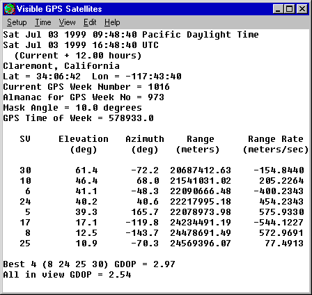
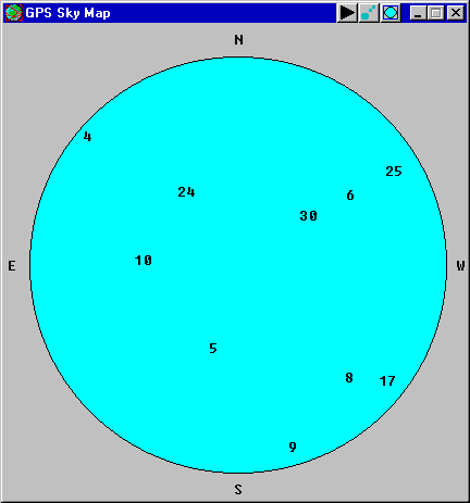
SatsUp provides a windowed text data display that is updated at 10-second intervals. The default display consists of the elevations, azimuths, ranges, and range rates of the visible satellites above the mask angle, and the GDOP (geometric dilution of precision) of the best set of four satellites and of all satellites above the mask angle. Other data items may be added to this display. SatsUp also displays a Sky Map that plots the satellite positions in the sky.
Various menu choices allow the user to set the time, to start and stop time and add offsets to it, to modify the data and the type of DOPs displayed, and to set parameters such as the user location and mask angle. The sky map has its own menu that allows animation of the map display and illustration of the satellite trails, as well as other options.
The flexibility of SatsUp allows it to be used in a variety of ways, from a general educational tool to learn about the GPS system, to a rigorous engineering tool for mission planning, simulation and data analysis.
The download file is an installation program. Download it to your hard disk and then double click it to install SatsUp and its help file. An uninstall option is provided.